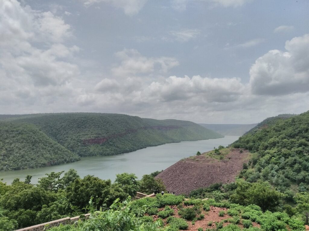
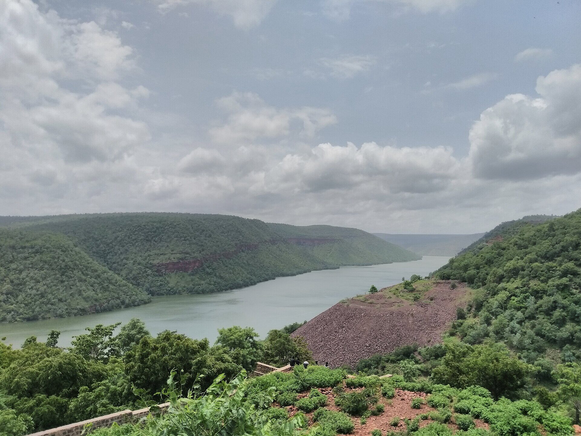
The Krishna River is the third-longest river in India and the second-longest peninsular river after the Godavari. Rising at Mahabaleshwar in the Western Ghats of Maharashtra, the Krishna flows for 1,400 km across four states — Maharashtra, Karnataka, Telangana and Andhra Pradesh — before emptying into the Bay of Bengal. Its basin covers about 258,948 sq km (roughly 8% of India’s area) and is the heart of the Deccan plateau‘s agricultural and industrial economy.
For UPSC, the Krishna River is consequential on three fronts: it is one of the most-developed peninsular basins (with major dams like Almatti, Srisailam, Nagarjuna Sagar and Prakasam Barrage), it is at the centre of one of India’s longest-running inter-state water disputes (between Maharashtra, Karnataka, Andhra Pradesh and Telangana), and its basin has shaped Indian civilisation — from the Satavahanas to Vijayanagara.
Quick Facts About the Krishna River
| Attribute | Detail |
|---|---|
| Source | Jor village near Mahabaleshwar, Satara district, Maharashtra |
| Elevation at source | ~1,337 m (Western Ghats) |
| Length | 1,400 km |
| Basin area | ~258,948 sq km (~8% of India) |
| Basin states | Maharashtra, Karnataka, Telangana, Andhra Pradesh |
| Direction | Generally east/southeast |
| Mouth | Bay of Bengal (Krishna delta near Hamsaladeevi, AP) |
| Major tributaries | Tungabhadra, Bhima, Koyna, Ghataprabha, Malaprabha, Musi, Dindi, Yerla |
| Major dams | Almatti, Srisailam, Nagarjuna Sagar, Prakasam Barrage, Koyna, Tungabhadra |
| Cultural status | Sacred river; Krishna Pushkaram every 12 years |
Source and Course of the Krishna River
The Krishna rises at Jor village near Mahabaleshwar in the Sahyadri (Western Ghats), at an elevation of about 1,337 metres. The river first flows east through the Mahabaleshwar plateau, descends to the Deccan plateau, and traverses Maharashtra, Karnataka, Telangana and Andhra Pradesh before reaching the Bay of Bengal.
Three Reaches
- Upper reach (Mahabaleshwar to Almatti): the river flows east-southeast through Maharashtra into northern Karnataka.
- Middle reach (Almatti to Srisailam): the Krishna enters the Deccan trap region and is joined by major tributaries — Tungabhadra and Bhima. The Srisailam gorge cuts through the Nallamala hills.
- Lower reach (Srisailam to the Bay of Bengal): the Krishna emerges onto the coastal plain, passes the Nagarjuna Sagar reservoir, the Prakasam Barrage at Vijayawada, and fans out into a delta.
Krishna Basin States
The Krishna basin is shared between four states:
- Maharashtra (~26%): upper Krishna basin including Pune, Sangli, Satara, Kolhapur.
- Karnataka (~44%): middle Krishna basin including Belagavi, Bagalkot, Vijayapura, Raichur.
- Telangana and Andhra Pradesh (~30% combined): lower Krishna basin including Hyderabad (Musi), Nalgonda, Krishna, Guntur, Prakasam.
After the 2014 bifurcation of Andhra Pradesh, water sharing between Telangana and AP became a fresh point of negotiation.
Tributaries of the Krishna
Right-bank Tributaries (longer, monsoon-fed)
- Koyna — rises in the Western Ghats; meets the Krishna at Karad (Maharashtra). Site of the Koyna Dam, one of India’s largest hydroelectric stations (1,960 MW).
- Ghataprabha — drains parts of Karnataka.
- Malaprabha — rises in the Western Ghats; meets the Krishna at Kudalasangama.
- Tungabhadra — the largest right-bank tributary, itself formed by the confluence of the Tunga and the Bhadra at Koodli in Karnataka. Drains the historic Vijayanagara region; supports the Tungabhadra Dam at Hospet.
Left-bank Tributaries (longer, drain larger area)
- Bhima — the longest tributary of the Krishna; rises in the Bhimashankar hills (Maharashtra) and joins near Raichur (Karnataka). The Bhima itself has tributaries like the Indrayani, Mula-Mutha (Pune), Ghod and Sina.
- Dindi
- Musi — drains Hyderabad; site of the 1908 floods and the Osman Sagar/Himayat Sagar reservoirs.
- Paleru
- Munneru
Major Dams on the Krishna
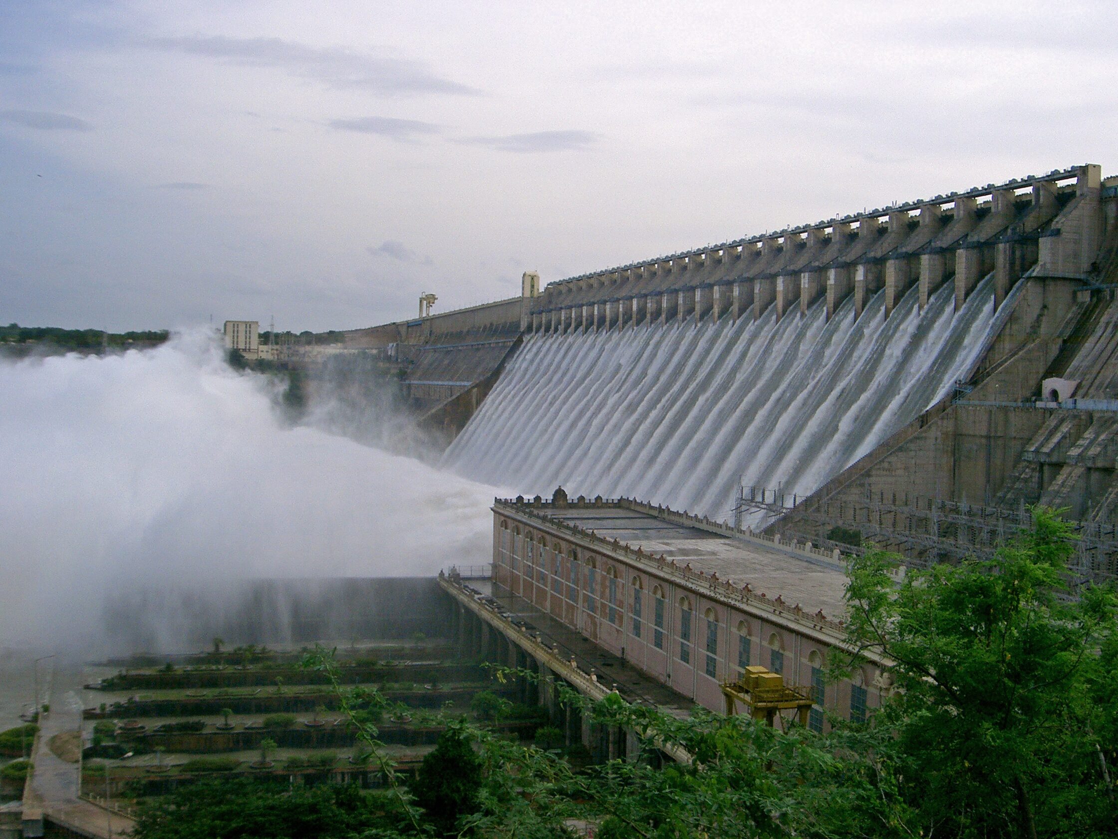
The Krishna basin is one of the most heavily dammed in India.
Koyna Dam (Maharashtra)
A rubble-concrete dam on the Koyna tributary; its underground powerhouse generates 1,960 MW, making Koyna the largest hydroelectric installation in Maharashtra.
Almatti Dam (Karnataka)
The Almatti Dam on the Krishna in Karnataka is the principal reservoir of the Upper Krishna Project. The height of Almatti has been a flashpoint in the Krishna Water Dispute because raising it submerges parts of Maharashtra.
Tungabhadra Dam
Joint Karnataka-Andhra Pradesh project on the Tungabhadra at Hospet; irrigates the Tungabhadra Left Bank Canal and the High Level Canal that feeds Rayalaseema.
Srisailam Dam
A 145-m masonry dam in the Nallamala hills (Telangana-AP border); 1,670 MW installed capacity; one of the largest hydroelectric stations in India. The reservoir houses the Srisailam Mallikarjuna Jyotirlinga.
Nagarjuna Sagar Dam
The flagship dam on the Krishna; covered separately in the next section.
Prakasam Barrage (Vijayawada)
The terminal barrage on the Krishna, downstream of Nagarjuna Sagar. It feeds the Krishna Western, Eastern and Central Delta canals and is the lifeline of Coastal Andhra agriculture.
Nagarjuna Sagar Dam
The Nagarjuna Sagar Dam, located on the Telangana-Andhra Pradesh border, is the masonry dam on the Krishna River at Nagarjuna Sagar. It was completed in 1969 and named after Acharya Nagarjuna, the second-century CE Buddhist scholar whose monastery once stood on what is now the reservoir bed (the Nagarjunakonda ruins were relocated to a hillock that now serves as an island museum).
Key Statistics
- Height: 124 metres
- Length: 1,550 m
- Reservoir capacity: ~11.5 billion cubic metres
- Installed hydropower: 816 MW
- Irrigation: ~10 lakh hectares across Telangana and Andhra Pradesh through the Nagarjuna Sagar Left Bank Canal (Lal Bahadur Shastri canal) and Right Bank Canal (Jawahar canal)
Significance
When commissioned, Nagarjuna Sagar was the largest masonry dam in the world and one of the largest man-made reservoirs. It remains a centrepiece of the lower Krishna’s irrigation grid, balancing demand between Telangana (which controls the left bank) and Andhra Pradesh (right bank) — a balance that has tightened since the 2014 bifurcation.
Krishna Water Dispute
The Krishna Water Dispute is one of India’s most consequential inter-state water conflicts, comparable in importance to the Cauvery water dispute.
Krishna Water Disputes Tribunal (KWDT-I, 1969–1976)
Set up under the Inter-State Water Disputes Act, the first Krishna Water Disputes Tribunal (chaired by Justice R.S. Bachawat) gave its award in 1973, allocating water as follows on the basis of 75% dependable flow:
- Maharashtra: 560 TMC
- Karnataka: 700 TMC
- Andhra Pradesh (undivided): 800 TMC
KWDT-II (Brijesh Kumar Tribunal, 2004–2013)
A second tribunal was constituted in 2004 because the first award’s validity expired in 2000. Its 2010 award, modified in 2013, allocated:
- Maharashtra: 666 TMC
- Karnataka: 911 TMC
- Andhra Pradesh: 1,005 TMC
The KWDT-II also addressed the surplus water above 65% dependability and recognised the Almatti height issue. The award has been challenged in the Supreme Court.
Post-2014 Dispute
After Andhra Pradesh’s bifurcation in 2014, Telangana asked for its own share — separate from Andhra Pradesh — but the Centre extended the existing arrangement. The Krishna River Management Board (KRMB) was constituted to administer waters between Telangana and AP. Disputes continue over Srisailam and Nagarjuna Sagar operations.
For the underlying constitutional framework, see Inter-state river water disputes and Article 262 of the Constitution.
Cultural and Religious Significance
- Srisailam Mallikarjuna, one of the twelve Jyotirlingas, sits on the southern bank of the Krishna in the Nallamala forest.
- Krishna Pushkaram — held every 12 years when Jupiter enters Virgo — draws millions of pilgrims to ghats at Vijayawada, Amaravati, Srisailam and other sites.
- The Krishna delta was the political heartland of the Satavahana dynasty (1st century BCE–2nd century CE).
- The Tungabhadra basin was the seat of the Vijayanagara empire, ruled by emperors like Krishnadevaraya.
- The Krishnarajasagara Dam on the Cauvery shares its name pattern but lies in a different basin — see Krishnarajasagara Dam.
Climate, Soils and Agriculture
- Rainfall: ~860 mm average — lower than the Godavari basin.
- Soils: Black cotton soil dominates the upper and middle basin; alluvium in the delta.
- Crops: rice (delta), cotton (Maharashtra and northern Karnataka), sugarcane (Maharashtra), groundnut, pulses, tobacco (Guntur).
Krishna Delta
The Krishna delta begins at the Prakasam Barrage in Vijayawada and fans out across roughly 5,000 sq km into the Bay of Bengal. The river splits into two main distributaries — the Krishna proper and the Nadi — and supports one of India’s most productive paddy belts. The delta also forms part of the Krishna Wildlife Sanctuary, which protects mangroves and Olive Ridley nesting grounds adjacent to the Godavari mangroves.
Environmental Concerns
- Reduced flows into the delta because of upstream impounding by Almatti, Srisailam and Nagarjuna Sagar.
- Saltwater intrusion into the delta and coastal aquifers.
- Heavy pollution of the Musi tributary by Hyderabad’s industrial and domestic effluents.
- Mangrove loss in the delta to aquaculture.
- Sand mining along the lower Krishna.
Krishna River — UPSC Significance
The Krishna River is a high-priority topic across the UPSC syllabus:
- GS-I Geography: Peninsular drainage, comparison with Godavari and Mahanadi, river-borne soils.
- GS-II Polity: Article 262, Krishna Water Disputes Tribunal, KWDT-II, KRMB, AP Reorganisation Act 2014.
- GS-III Environment: dams and displacement, delta ecology, mangroves, river pollution.
- Prelims: source, length, tributaries (Bhima, Tungabhadra, Koyna), dams (Almatti, Srisailam, Nagarjuna Sagar, Tungabhadra), Krishna Pushkaram, Krishna basin states.
Useful adjacent reading: the Brahmaputra inland waterways push (a different drainage regime), the Bhakra Dam (a north-Indian multipurpose project), Hirakud Dam on the Mahanadi (another peninsular dam), and flood management in India and drought in India for the wider hydrological context.
Frequently Asked Questions
What is the source of the Krishna River?
The Krishna River rises at Jor village near Mahabaleshwar in Satara district of Maharashtra, in the Western Ghats, at an elevation of about 1,337 metres.
How long is the Krishna River?
The Krishna River is 1,400 km long, making it the third-longest river in India and the second-longest peninsular river after the Godavari.
Which states does the Krishna basin cover?
The Krishna basin is shared by four states: Maharashtra (~26%), Karnataka (~44%), Telangana and Andhra Pradesh (~30% combined). Post-2014, water sharing between Telangana and AP is administered by the Krishna River Management Board.
What are the major tributaries of the Krishna?
The major left-bank tributary is the Bhima (longest tributary, with sub-tributaries like the Indrayani, Mula-Mutha and Sina). Major right-bank tributaries include the Tungabhadra, Koyna, Ghataprabha and Malaprabha.
What is the Krishna Water Dispute?
The Krishna Water Dispute is an inter-state dispute over Krishna waters between Maharashtra, Karnataka and undivided Andhra Pradesh (now Telangana and AP). The first KWDT (1969–1973) and the second KWDT (2004–2013) issued awards under the Inter-State River Water Disputes Act, allocating water on the basis of 75% dependable flow.
What is the Nagarjuna Sagar Dam?
The Nagarjuna Sagar Dam is a 124-m masonry dam on the Krishna River at the Telangana-AP border. Completed in 1969, it is one of the largest masonry dams in the world, has 816 MW installed capacity and irrigates ~10 lakh hectares.
Where does the Krishna River end?
The Krishna empties into the Bay of Bengal through a delta downstream of Vijayawada in Andhra Pradesh. The delta begins at the Prakasam Barrage and covers about 5,000 sq km.
What is the Krishna Pushkaram?
Krishna Pushkaram is a Hindu festival held every 12 years when Jupiter enters the zodiac sign Virgo. Pilgrims gather at sacred ghats along the Krishna — particularly at Vijayawada, Amaravati and Srisailam — to bathe and perform rituals.
Tell Google you want more of this.
Add Anantam IAS as a preferred sourceOne tap, and this site shows up more often in your own Top Stories, AI Overviews and AI Mode. Remove it any time.